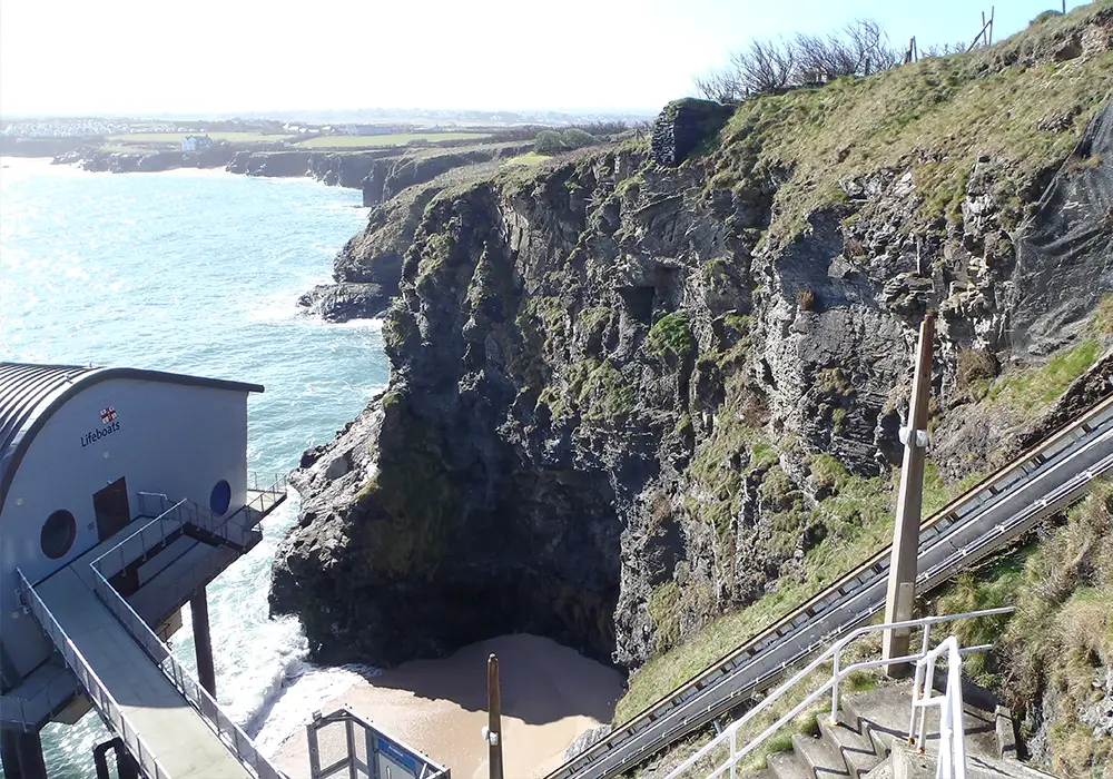
JGP has a strong team of engineering geologists and geotechnical engineers that regularly carry out slope stability assessments and surveys, stabilisation works and risk management of cliffs and coastal slopes, quarry faces, rock and soil cuttings and embankments. We have over 80 years of combined experience, our team includes chartered geologists and IRATA-trained staff, providing first-class geotechnical and geological surveys, roped access inspections, remedial designs, and risk management.
We offer a range of bespoke cliff stability and coastal erosion assessments, which can be tailored to your specific needs.
Comprehensive Assessments & Surveys
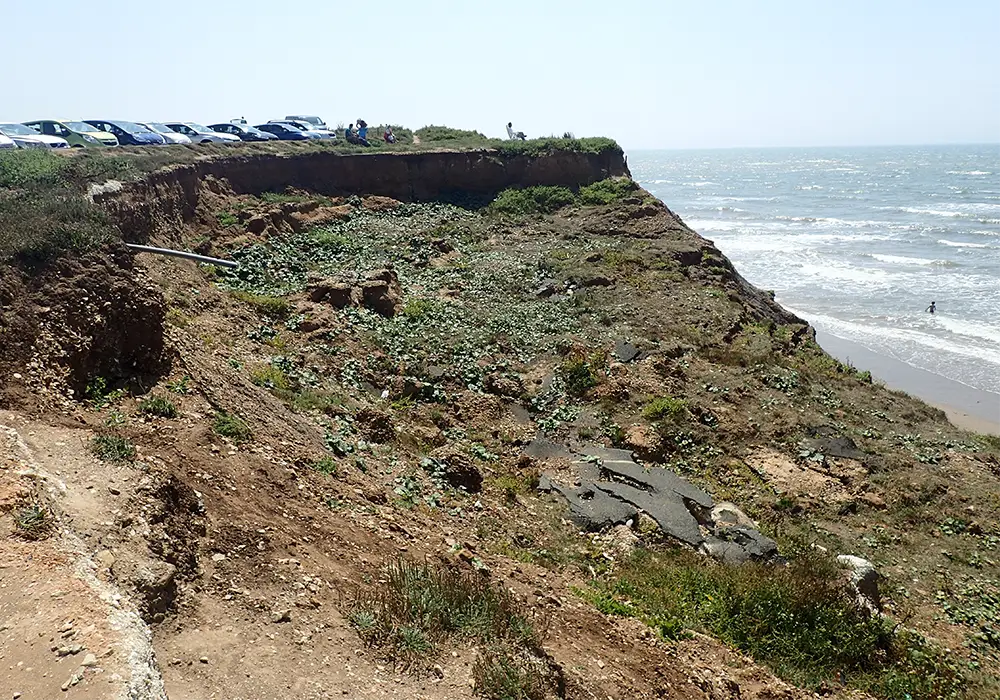
JGP can help clients to understand and manage risks from landslides, landslips and rockfalls, whether you are looking to purchase a site, develop and build on coastal land, or have experienced a landslip.
Our Geology Team works closely with our ground engineering, civil engineering, and structural engineering departments to provide remedial solutions to address identified instability issues, with proven experience in taking projects through subsequent project stages including design, construction supervision, and later inspection and maintenance regimes.
Desk-Based Assessments & Visual Inspections:
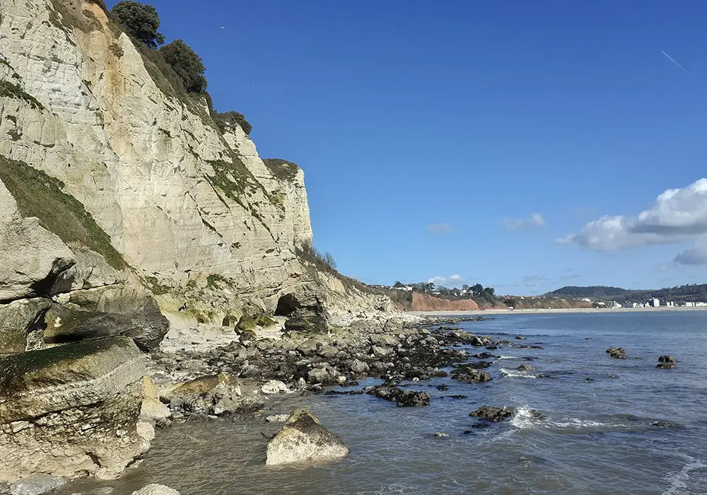
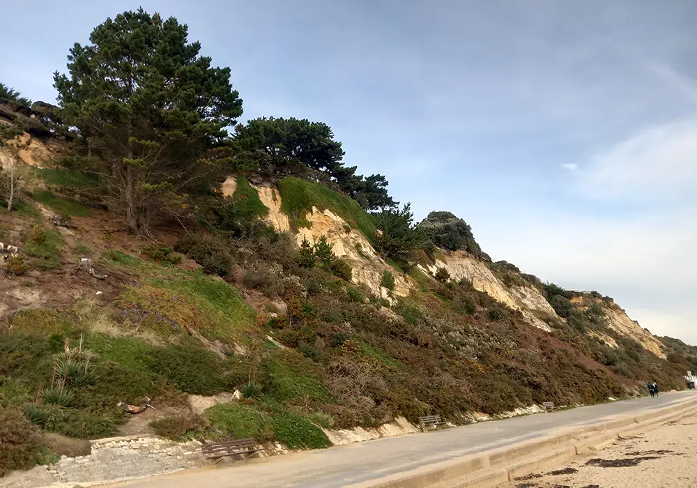
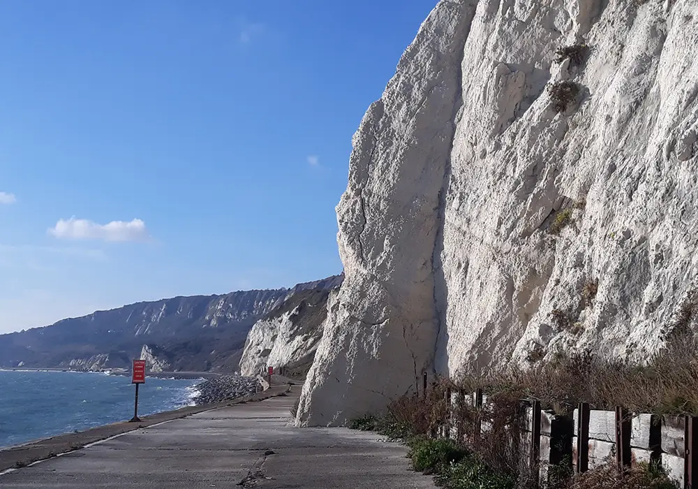
JGP are experienced in undertaking desk-based and visual inspection assessments for cliff and coastal stability. We can provide pre-purchase/sale reports for conveyancing or Coastal Vulnerability Assessments for Planning. For more information on Coastal Vulnerability Assessments.
Desk-based Assessments include a review of published data. For coastal assessments, this would include reviewing the Shoreline Management Plan (SMP) for the area, to see what the current guidance is on protection measures; the erosion projections provided in National Coastal Erosion Risk Management (NCERM) data; existing local coastal protection measures and published data on erosion and coastline regression. Historic maps dating back to the 1860’s are also reviewed to determine the historic rate of cliff retreat. Cliff and beach profiles from recent (circa 2007 to present) LiDAR imagery and aerial imagery are also assessed.
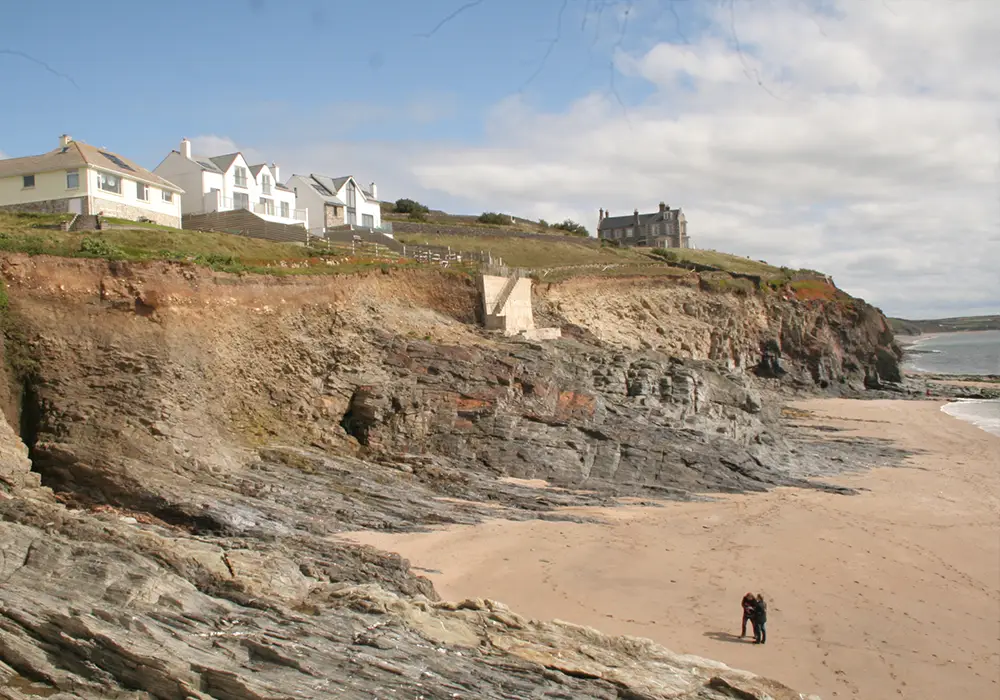
Site Visits & Visual Inspections
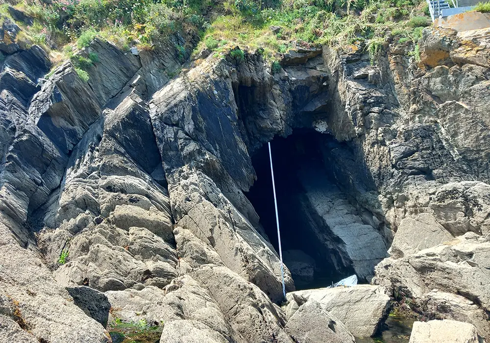
Site visits and visual inspections are carried out by our experienced Engineering Geologists, to observe and record the engineering geological and coastal conditions and where appropriate take rock mass geometry readings (recording of rock joints, faults, etc.) for kinematic analysis.
Detailed Site Assessment Methods
JGP can employ various additional methods to undertake a detailed analysis of coastal slopes, which are selected based on our client’s requirements and site-specific conditions.
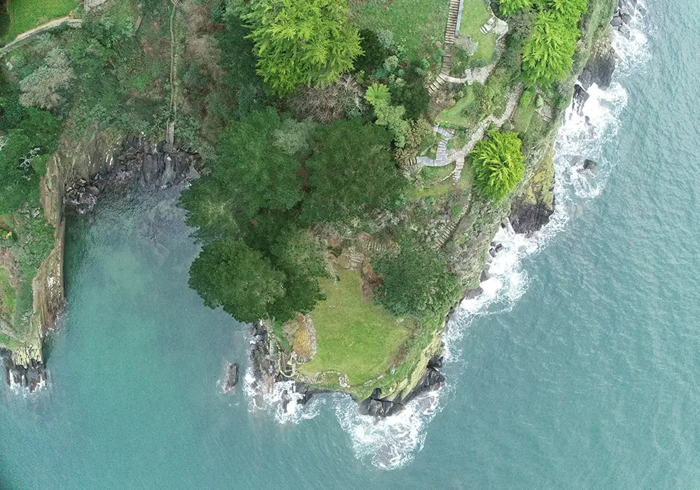
Drone Surveys
Which together with the rock mass geometry data recorded by our engineers, will produce a 3D model for the stability assessment. The drone survey will involve flying the area using a Phantom 4 RTK multi-rotor drone, which includes picking up ground control points that are coordinated to Ordnance Survey grid and level datum using GPS (Trimble VRS). The imagery would then be processed in Pix4D using the GCP’s and the coordinates would bring the imagery and deliverables in on to the OS grid and level datum.
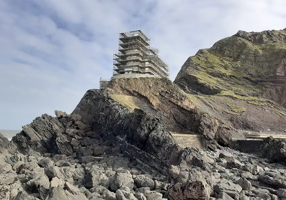
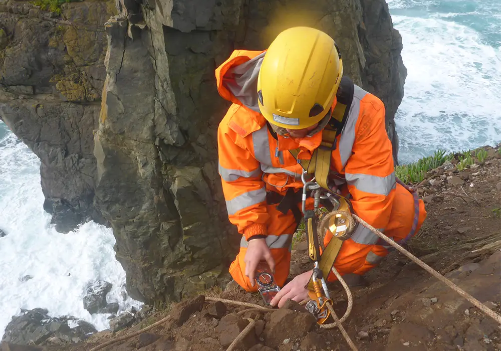
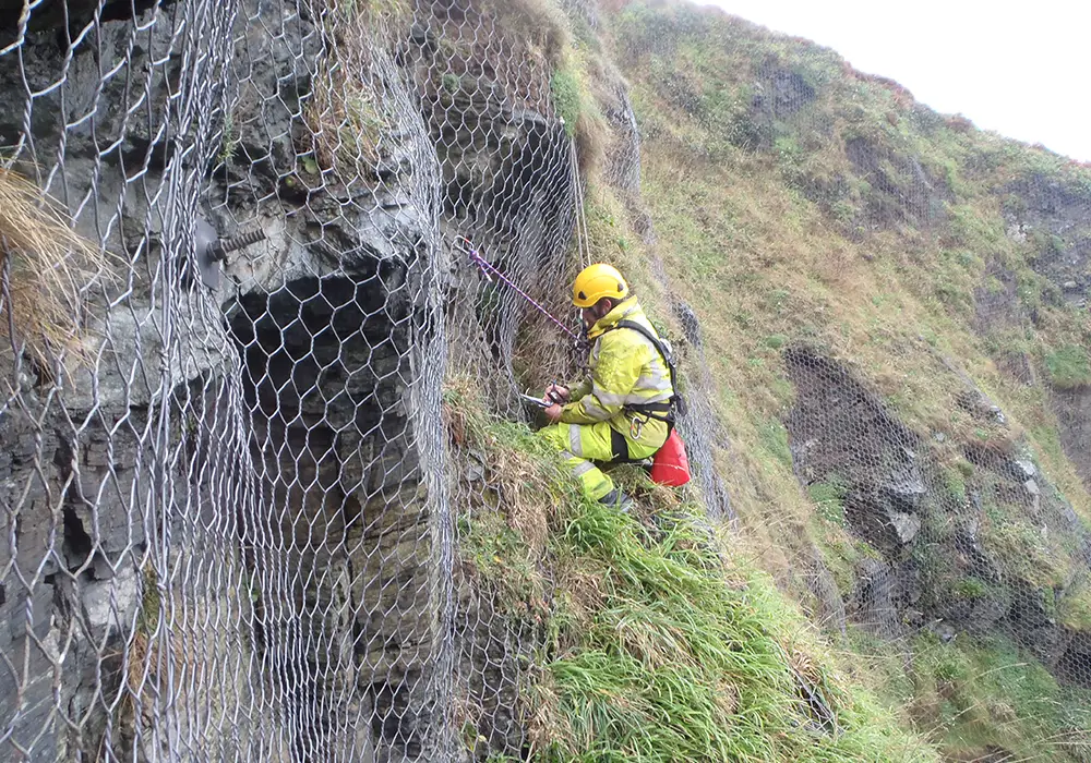
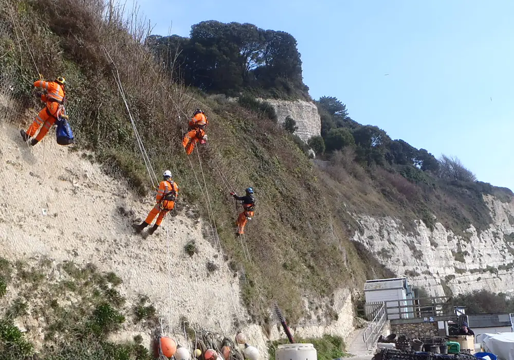
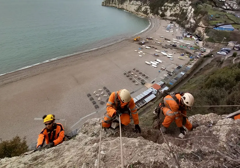
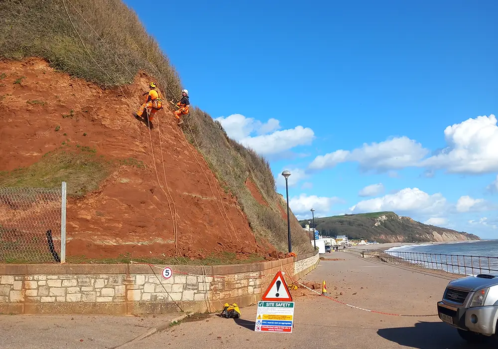
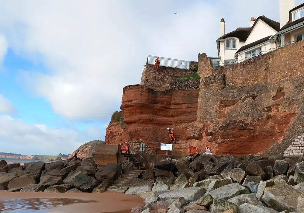
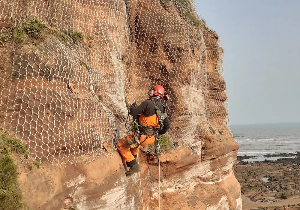
Rope Access Inspections
These are carried out by our Engineering Geologists who observe and record the geology and rock geometry over the full height of the slope. The inspection of the slope/cliff would be limited to observing conditions as exposed; therefore, there may be a requirement for thick vegetation to be cleared to enable our engineers to fully evaluate the rock mass.
Ground Investigations
Where ground conditions to the rear of the slope need to be assessed, our engineers can employ the various ground investigation techniques listed here [link to our GI page]. Our experienced team will be able to advise on the appropriate methodologies for the site conditions.
Photogrammetry
our engineers may take overlapping photographs of a section of cliff. Point cloud data analysis software is then used to generate a 3-D digital model.
Laser Monitoring
Marker points can be installed at strategic locations to facilitate accurate laser measurements of features over time, in order to assess rates of erosion.
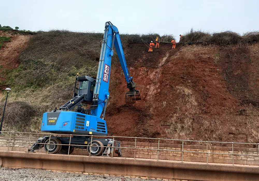
Asset management – Landslip Prevention and Mitigation Services
JGP offers a wide range of long-term cliff and slope instability remediation design services, which are tailored to the site-specific circumstances and our client’s requirements. We can provide various options for engineered remedial solutions or provide advice and asset management to manage geohazards and mitigate risks.
JGP can provide pragmatic and cost-effective assessments and advice to managing risks from slope and cliff instability. We also provide public safety rock fall risk assessments and mitigation services.
Our experienced rope access team also undertake monitoring and maintenance surveys, which can include:
Rock Scaling
Rock scaling – rope access inspections will identify any loose rocks prone to falling. These can be scaled in a controlled manner to mitigate risks to people and property.
Vegetation Management
Vegetation management – invasive roots can pry apart rock leading to instability. The inspections can include removing invasive vegetation or managing growth height to prevent increased loading of soil slopes.
Inspection of existing stabilisation measures
Inspection of existing stabilisation measures – any existing rock anchors / soil nailing, mesh, etc. can be inspected to assess their continued functionality.
For expert assessment and management of landslips, landslides, and rock falls, JGP offers tailored solutions to address your specific needs. Our team of experienced engineering geologists and geotechnical engineers provides comprehensive slope stability assessments, surveys, and remedial designs for cliffs, coastal slopes, quarry faces, and more.
Contact us today to discuss your project or concern, book an assessment, or learn how our expert team can help you manage and mitigate the risks associated with slope and cliff instability. We’re here to ensure your site remains safe and secure.